Sustainable City
Volunteered Geographic Information
Crowd-sourced Data for Disaster Preparedness: Caferağa and Hasanpaşa Mapping Workshops
According to the report published by DEZİM (Istanbul Metropolitan Municipality Earthquake and Soil Investigation Directorate) in 2020, Kadıköy is among the first-degree earthquake zones in Istanbul. According to the study, 6717 buildings in the district will be damaged in a possible earthquake with a magnitude of 7.5 and above. For this reason, the current conditions and detailed information of both the housing buildings and the emergency assembly areas are very important for the region.
Volunteered Geographic Information (VGI) for Sustainable Cities project, which asks how to design a process to make quick decisions before and after an earthquake without relying on technology, argues that disaster data can be collected through crowd-sourced methods. For this purpose, a mapping workshop was organized both on September 10 and 17, 2022 by the Turkish Economic and Social Studies Foundation and Yer Çizenler Mapping for Everyone Association. In the first workshop, in which MAGAME (Neighborhood Disaster Volunteers Emergency Response Team) volunteers also participated, efforts were made to develop the OpenStreetMap data of Yoğurtçu Park and its surroundings in Caferağa District of Kadıköy. In the second workshop, OpenStreetMap base maps and data of Muze Gazhane and its surroundings, which is an emergency assembly area in Kadıköy Hasanpaşa Neighborhood, were studied and detailed.
The workshop emphasized the importance of open source data. Information about emergency assembly areas is published on the websites of local governments as a list within the boundaries of the municipality or the data can be visualized in the e-devlet application, depending on the address-based population registration system. This application also uses OpenStreetMap basemaps while showing geographically coordinated emergency assembly areas. Therefore, the importance of these base maps for disaster management and coordination significantly increases. In addition, since the data is open source, it can be mapped quickly with the help of not only national but also international volunteers. Thus, data can be detailed quickly and without the need for large-scale projects.
The event held in Hasanpaşa is the last workshop for this data collection method within the scope of the project. It is planned to publish a report about other workshops, project activities and their evaluation organized by TESEV in Kadıköy Caferağa, Bodrum and Hatay. Thus, it is aimed both to inform more volunteers of this crowdsourced data collection method and to support decision-makers' work and cooperation on community-based data collection methods.
Open-Source Mapping for Disaster Preparedness: Workshop with Hatay AFAD
Hatay, especially the Antakya region, which is the historical city center, has been struggling with earthquakes, fires and floods for many years. Mehmet Bozkurt, Secretary General of Hatay Metropolitan Municipality City Council, states that frequent low-intensity earthquakes have almost become a part of everyday life. This puts Hatay in an important place while dealing with disasters, especially earthquakes. Within the scope of the Voluntereed Geographic Information for Sustainable Cities (VGI) project, a field trip to study on disaster preparedness was organized by Turkish Economic and Social Studies Foundation (TESEV) and Yer Çizenler Mapping for Everyone Association to Hatay and Antakya as one of the city centers.
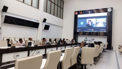
The workshop, which was held with the employees of Hatay Governorship Disaster and Emergency Management Presidency (AFAD) on June 17th, started with a presentation of Gizem Fidan from TESEV on information about the project. Following, Hüseyin Can Ünen and Zafer Batık from Yer Çizenler Mapping for Everyone Association informed participants about the impact of open-source mapping and volunteer networks on disaster preparedness. The event focused on how Open Street Map and its international volunteer network can assist in pre-disaster preparedness and post-disaster coordination. In the second part of the workshop, the participants were informed about how to use the interface and edit the existing data. AFAD employees drew the Hatay AFAD campus, where the event was held, on OSM base maps. At the end of the event, the participants stated that the tool can be useful, and emphasized the importance of the data required for pre-earthquake preparation and emergency response. In addition, the common aspects of the OSM and AFAD's existing remote sensing and disaster mapping studies were emphasized, and the integration of the two systems and possible areas of use were discussed.
Disaster Coordination and Hatay Metropolitan Municipality
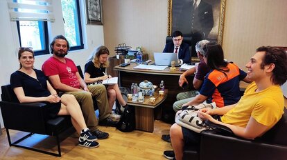
During the study visit, two different meetings were held with Hatay Metropolitan Municipality to discuss disaster preparedness and management. The first meeting was held with City Council Secretary General Mehmet Bozkurt and City Council Secretary Sonay Karaman. At the meeting, open-source mapping and its tools were discussed, and information was received about the works of Hatay Metropolitan Municipality. It was stated that the Youth Assembly of the City Council can be particularly interested in open-source mapping interfaces.
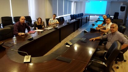
Another meeting with Hatay Metropolitan Municipality was held with the Departments of Urban Planning, Transportation, IT, Fire Brigade, and GIS, Projects and Disaster Coordination units. In this meeting, attended by all units working on disaster preparedness and coordination, Disaster and Coordination Unit Diretor Aykut Sarp stated that all layers of Hatay related to disasters should be mapped. Emphasizing that information such as road networks, emergency assembly areas and ground/ soil characteristics are collected within the municipality, Aykut Sarp emphasized the importance of mapping studies on this subject. Stating that the decisions to be taken for disaster preparedness especially in the city center of Antakya are difficult due to the dense texture and historical structure of the city, Aykut Sarp stressed that open-source mapping can help in this regard, but additional studies are needed for data validation. Pre-disaster mapping studies of Hatay Metropolitan Municipality and its related units continue.
Many citizens still remember the few hours that phone lines were locked and people's access to each other was cut off after the 5.8 magnitude Istanbul earthquake in 2019. A similar process was unfortunately experienced in the Izmir earthquake in 2020 has recalled the questions that have been asked for years about access to information and data after the disaster. Forest fires in the summer of 2021 has again showed how much making incisive decisions and organizing necessary resources depends on the data flow between the disaster area and the center and the help of volunteer networks.
Turkish Economic and Social Studies Foundation (TESEV) has been working on “Supporting Sustainable Cities” since 2016 with the support of the Friedrich Naumann Foundation for Freedom. Within this framework, Volunteered Geographic Information (VGI) for Sustainable Cities project that started in 2022 questions how a process can be designed to allow the free flow of local information and with the voluntary participation of communities in disaster management.
Being able to make quick and accurate decisions after an earthquake is directly related to the preparations made before the disaster. For this reason, project sets out with the assumption that technology will not work after a disaster and makes a new proposal for mapping, especially housing stock, with using only paper and pencil. In the mapathon, organized in partnership with TESEV and Yer Çizenler Mapping for Everyone Association, we worked on the completion of the Open Street Map base maps of Hasanpaşa, Eğitim and Fikirtepe neighborhoods in Istanbul Kadıköy. In the event that disaster volunteers from Kadıköy mainly attended, we talked about both the project and the use of open-source tools to managing disasters such as Open Street Map (OSM).
Open Source Data and Volunteer Network in Disaster Management
“The Open Street Map (OSM) provides a network of volunteers and data that you can quickly access for mapping before or after a disaster,” says Hüseyin Can Ünen while underlining that these maps, which can be viewed and edited online for free, can provide a base even when there is no internet connection. Therefore, drawings made with satellite images by volunteers from different corners of the world can be detailed again with volunteer work in the field at the neighborhood scale. For example, the building base maps completed by OSM network after the Izmir earthquake can be detailed again by volunteers with field papers method that only needs paper and pencil. This makes it possible to determine how durable a building is before the earthquake, while after the earthquake the demolished buildings therefore, the help needed can be mapped.
In the next phase of the Volunteered Geographic Information (VGI) for Sustainable Cities project, field studies will be carried out in two neighborhoods of Istanbul by TESEV and Yer Çizenler with the help of volunteers by using OSM base maps. Mapping studies will be carried out by using field papers technology with the help of MAGAME (Neighborhood Disaster Volunteers Emergency Response Association) and TRAC in the neighborhoods of Caferağa in Kadıköy and Gümüşpala in Avcılar.
Open-Source Mapping for Disaster Preparedness: Field Study with Bodrum Disaster Volunteers
According to the evaluation report published by the Muğla General Directorate of Forestry, in 2021, and 52219.50 hectares of land burned with 369 forest fires across the province. While this number is 815,192 hectares with 329 fires in 2020, the number drops to 302 fires in 2019. This shows that the increase of forest fires as well as wider fire zones because of delayed response due to flames that broke out at the same time.
Muğla's Bodrum district is one of the places that is in danger of fire and corporates with volunteers on this issue. The district is also working on earthquake preparedness. It can be thought that the 6.6 earthquake and flood experienced in 2017 accelerated these studies. Bodrum Municipality and Bodrum MAGAME (Neighborhood Disaster Volunteers Emergency Response Team) is working to be prepared for all disasters. For this reason, within the scope of the Volunteered Geographic Information (VGI) for Sustainable Cities project, a study was carried out in Bodrum by the Turkish Economic and Social Studies Foundation (TESEV) and Yer Çizenler Mapping for Everyone Association, in order to both get information about their efforts and organize a workshop on new tools that can be used.
Bodrum Municipality in Disaster Coordination
Bodrum Municipality was visited first in order to learn about disaster measures and coordination studies and to give information about the project. Emphasizing that Bodrum has 11 centers, Executive Assistant Çağdaş Uyar stated that communication between these centers is necessary for disaster coordination, but also one of the biggest challenges, due to district’s topographic structure and road networks. Underlining the necessity of a volunteer network in order to provide communication with the districts in cases such as earthquakes, fires and floods, Çağdaş Uyar also stated that the tools that will provide the communication between these networks are also important.
Bodrum Municipality IT Directorate is working on a disaster coordination center project for similar purposes. Director of Information Technologies Kaan Yorga states that if the center, of which volunteers and non-governmental organizations are a part, is completed, the effects of disasters in Bodrum will be reduced and it will set an example for other municipalities. The project process continues.
Mapping Workshop with Bodrum Volunteer Network
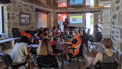
As part of the study trip, a workshop was held with Bodrum MAGAME in the Umurça Park Nazım Hikmet Library. Orkut Murat Yılmaz and Eray Öztürk from the Yer Çizenler Mapping for Everyone Association gave information about open source and free software mapping interfaces within the scope of the workshop. They also exemplified how these tools can be used in case of a disaster. In this context, Umurça Park base maps which is an emergency assembly area that does not have data on OSM, were first completed by participants from the neighborhood disaster volunteers. Field Papers maps were prepared, and volunteers did a field study to complete the data.
Volunteers, who mapped the road, court and other details of the park using paper and pencil during the fieldwork, transferred this data to OSM base maps after the field study was completed. In addition, volunteers stated that this method could be used especially to mark the roads they use in the fire and to share with other volunteers or to develop alternative transportation routes to the roads deteriorated in the earthquake.
Umurça Park data, which is one of the activity outputs, can be viewed on OSM. Within the scope of the project, a similar workshop will be held in Istanbul by TESEV and Yer Çizenler Mapping for Everyone Association.
